Reelfoot Lake Maps boat ramps access
Shop Reelfoot Lake--Tennessee
 Reelfoot Lake Crappie sticker Tennessee fishing decal
Reelfoot Lake Maps
On Google’s Reelfoot Lake Map use controls to scroll, zoom, topography/terrain, charts, satellite, geography etc
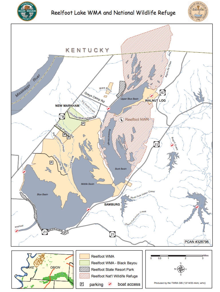
TWRA and Corps Of Engineers Reelfoot Lake Maps charts below

Map Courtesy of TWRA Region 1
Click on links for close up map of boat ramps and access areas
- Airpark (1)
- Champey Pocket (2)
- Grassy Island (3)
- Gray’s Camp (4)
- Keystone Park (5)
- Kirby Pocket (6)
- Lassiter Landing (7)
- Little Ronaldson (8)
- Long Park (9)
- Lovell’s Landing (10)
- Sunset Court (11)
- Walnut Log (12)
- Washout (13)

Reelfoot Lake and Lake Isom Map
Reelfoot National Wildlife Refuge Grassy Island and Long Point Units map locations
Lake Isom National Wildlife Refuge map locations
Wildlife Refuge Map Courtesy of Reelfoot National Wildlife Refuge
and the US Fish & Wildlife Service

Reelfoot Lake Map Courtesy of TWRA
Link to download of high resolution PDF

Reelfoot Lake Map 1905