Tims Ford Lake Maps
Shop Tims Ford Lake--Tennessee
 Tims Ford Lake Largemouth Bass decal Tennessee sticker
 We Love Tims Ford Lake sticker decal
 Tims Ford Lake Striped Bass decal sticker Tennessee
Tims Ford Lake Maps
On Google’s Tims Ford Lake Maps use controls to scroll, zoom, topography/terrain, charts, satellite, geography etc
TWRA and Corps Of Engineers Tims Ford Lake Maps charts are below
*Tims Ford Lake Maps and charts are available commercially from:
Atlantic Mapping, Inc. PO Box 7391 Marietta, GA. 30065 770-426-5768 http://www.atlanticmapping.com/
*Localwaters provides information on commercial charts availability as a public service. This is not an endorsement nor do we receive compensation from Atlantic Mapping.
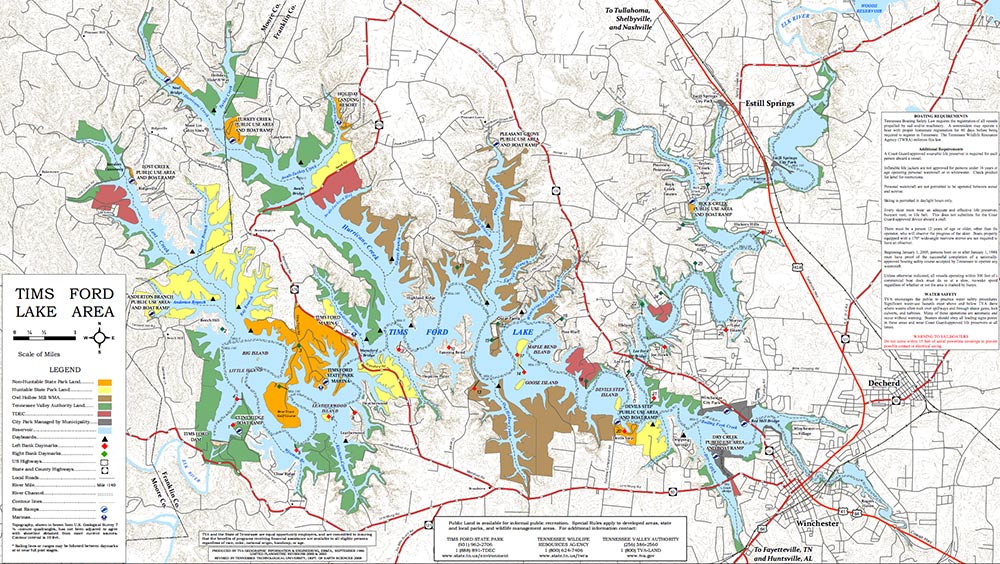
Tims Ford Lake map with marinas and ramps
Link for direct download of PDF file for printing (higher resolution)

Map Courtesy of TWRA Region 2
Click on links below for close up maps of boat ramps and
access areas on Tim’s Ford Lake
- Anderton Branch (1)
- Bass Club (2)
- Devil’s Step (3)
- Dry Creek (4)
- Estill Springs Park (5)
- Holiday Landings Resort (6)
- Lost Creek (7)
- Neal’s Bridge (8)
- Pleasant Grove (9)
- Rock Creek (10)
- Tims Ford Marina (11)
- Tims Ford State Park Marina (12)
- Turkey Creek (13)
- TVA Boat Ramp at Dam (14)
- Tim’s Ford Reservoir Boat Ramps
Maps below are of the Elk River Watershed which Tims Ford Lake is a part of

Tims Ford Lake Map within the Elk River Watershed

Tims Ford Lake Map within the Elk River Watershed


Tims Ford Lake Map within the Elk River Watershed
