Red River Maps boat ramps access areas
Shop Red River--Tennessee
 Red River Smallmouth Bass sticker Tennessee decal
Red River Maps
On Google’s Red River Map use controls to scroll, zoom, topography/terrain, charts, satellite, geography etc
TWRA and Corps Of Engineers Red River Maps charts below

Map courtesy of TWRA Region 2
Click on link below for close up of boat ramps and access areas
Port Royal State Park (1)

Red River map of regional hydrology and location within the State of Tennessee

Map of Red River with Tennessee counties within the watershed
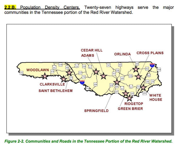
Map of Red River watershed with towns and highways within the watershed.
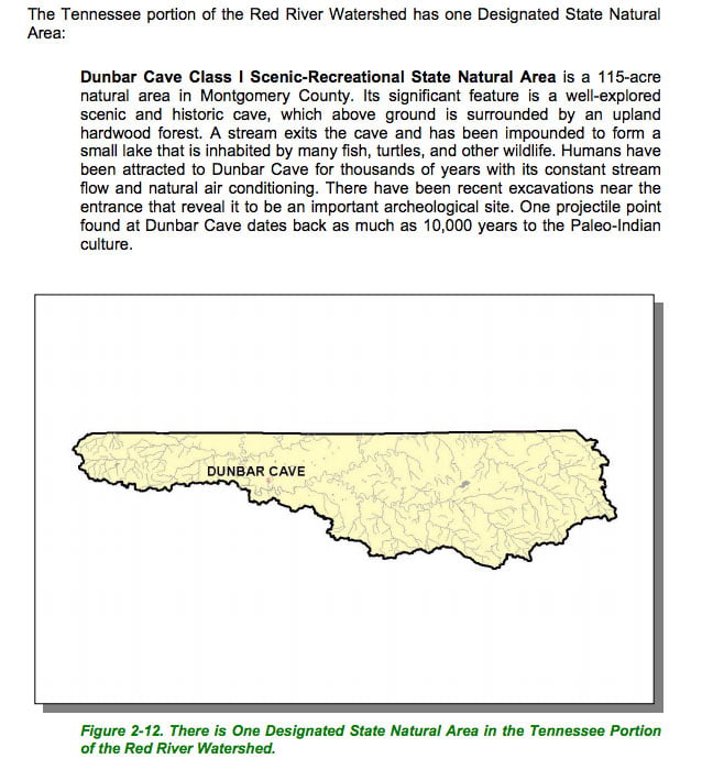
Map of Red River watershed with natural areas
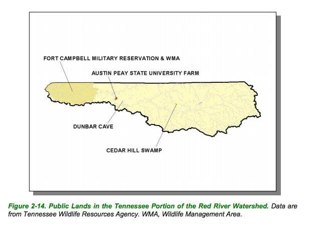
Map of Red River watershed public lands
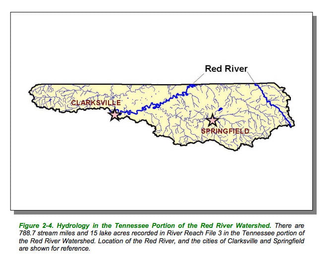
Red River map of the watershed hydrology
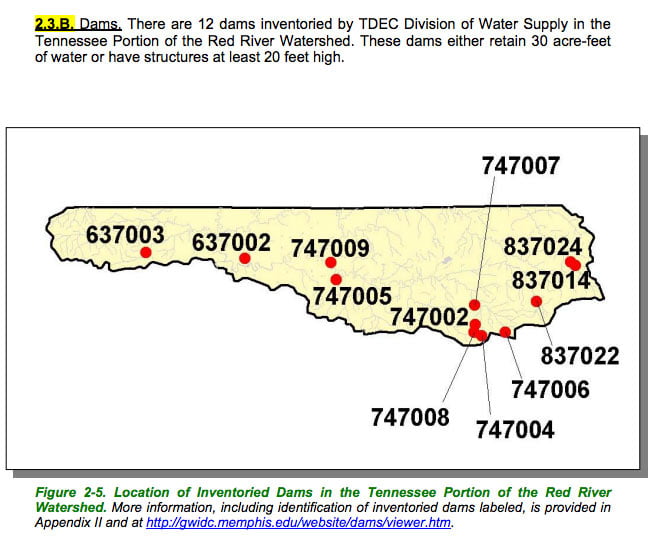
Red River watershed map of dams
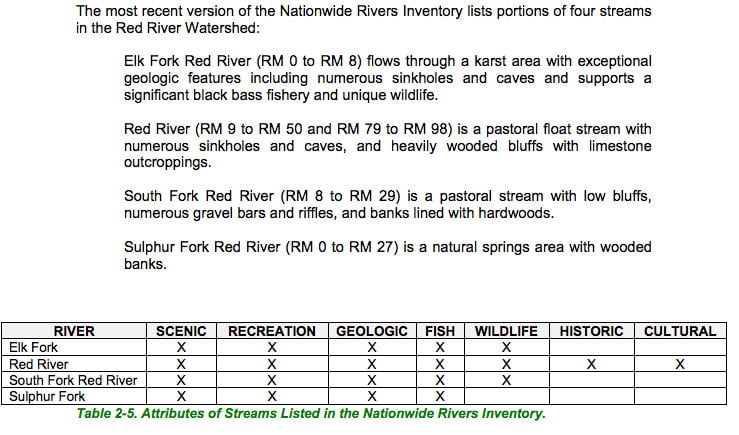
List of Red River watershed streams with good fishing and or scenic qualities
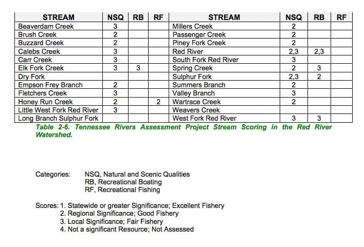
List of Red River watershed streams rated with fishing and recreation etc