Nolichucky River Maps Access Area Boat Ramps
Shop Nolichucky River--Tennessee
 Nolichucky River Canoe sticker Tennessee decal
 Nolichucky River Smallmouth Bass sticker Tennessee decal
 Nolichucky River Kayak sticker Tennessee decal
Nolichucky River Maps
On Google’s Nolichucky River Map use controls to scroll, zoom, topography/terrain, charts, satellite, geography etc
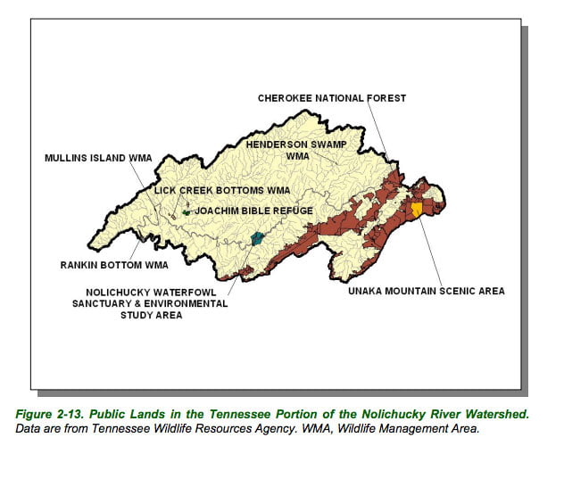
TWRA and Corps Of Engineers Nolichucky River Maps charts below

Map courtesy of TWRA Region 4
Click the links to see close up map of access points
- Bewley’s Bridge (1)
- Bird’s Bridge (2)
- Chestoa (3)
- Davy Crockett Dam (4)
- Davy Crockett State Park (5)
- Easterly Bridge (6)
- HWY 321 Bridge (7)
- Jackson Island (8)
- Kinser Bridge (9)
- Kinser Park (10)
- Pates Hill (11)


Maps and Facts Courtesy of TN Department of Environment & Conservation