Melton Hill Lake / Reservoir Maps Boat Ramps
Shop Melton Hill Lake Reservoir--Tennessee
 Melton Hill Lake muskie musky muskellunge sticker Tennessee decal
 Melton Hill Largemouth Bass sticker Tennessee decal
On Google’s Melton Hill Lake Map use controls to scroll, zoom, topography/terrain, charts, satellite, geography etc
TWRA and Corps Of Engineers Melton Hill Reservoir Lake Maps charts below
*Melton Hill Lake Maps and charts are available commercially from:
Atlantic Mapping, Inc. PO Box 7391 Marietta, GA. 30065 770-426-5768 http://www.atlanticmapping.com/
*Localwaters provides information on commercial charts availability as a public service. This is not an endorsement nor do we receive compensation from Atlantic Mapping.

-
- Above map courtesy of TWRA Region 4
- Click the links on the boat ramps to see close up maps
- Dismal Bluff (1)
- Edgemoore (2)
- Melton Hill Marina (3)
- Oak Ridge Marina (4)
Link to New TWRA Maps of Marinas and Boat Ramps on Melton Hill Reservoir
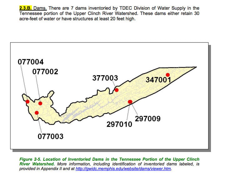
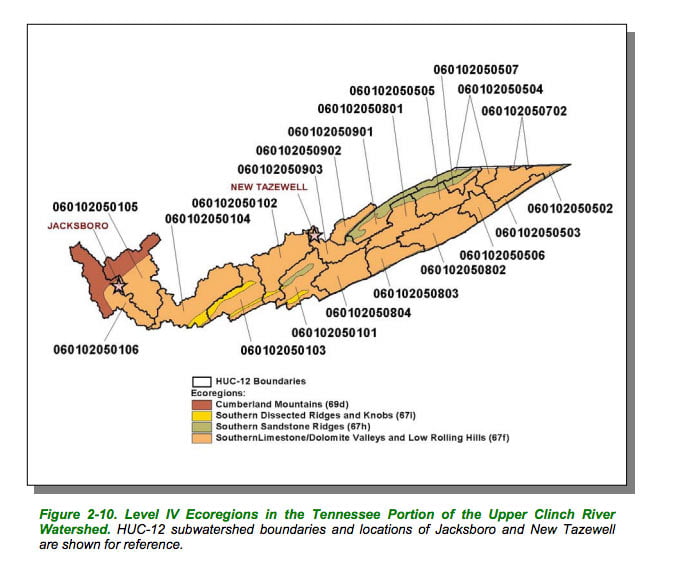
Maps below are of the Clinch River Watershed of which Melton Hill Lake is a part
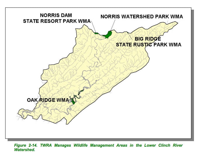
Melton Hill Lake Map with Clinch River watershed map of TWRA Wildlife Management Areas
Courtesy of TN Department of Environment & Conservation

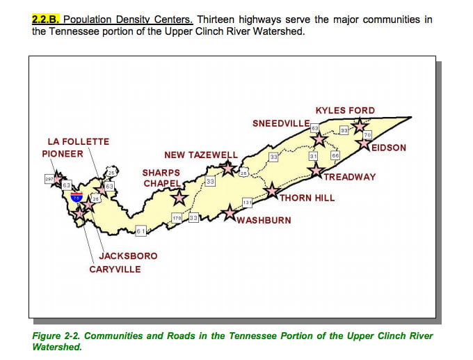
Clinch River map of towns, cities, highways in watershed
Courtesy of TN Department of Environment & Conservation

Melton Hill Lake Map with Clinch River map state Scenic river portion
Courtesy of TN Department of Environment & Conservation

Melton Hill Lake Map of Clinch River watershed public lands
Courtesy of TN Department of Environment & Conservation

Clinch River map of ecoregions in watershed
Courtesy of TN Department of Environment & Conservation
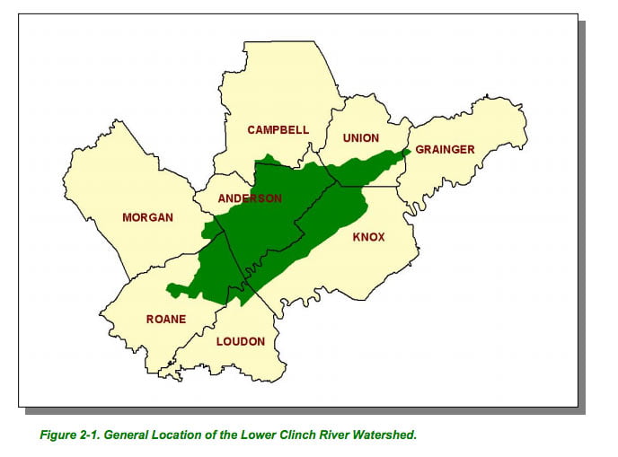
Clinch River map counties in watershed
Courtesy of TN Department of Environment & Conservation

Melton Hill Lake Map Clinch River map (lower) hydrology of southern portion of watershed
Courtesy of TN Department of Environment & Conservation
Courtesy of TN Department of Environment & Conservation
Courtesy of TN Department of Environment & Conservation
Courtesy of TN Department of Environment & Conservation

Courtesy of TN Department of Environment & Conservation
Courtesy of TN Department of Environment & Conservation