Little Tennessee River Maps
Shop Little Tennessee River--Tennessee
 Little Tennessee River Smallmouth Bass sticker
 Great Smoky Mountains National Park Fly Fishing sticker decal
Little Tennessee River Maps
123On Google’s Little Tennessee River Map use controls to scroll, zoom, topography/terrain, charts, satellite, geography etc
TWRA and Corps Of Engineers Little Tennessee River Maps charts below
Little Tennessee River Section: Fontana Lake-Cheoah Lake-Calderwood Lake-

Little Tennessee River map of counties within the watershed
Courtesy of TN Department of Environment & Conservation
Little Tennessee River Section: Chilhowee Lake-Tellico Lake-Confluence of The Tennessee River
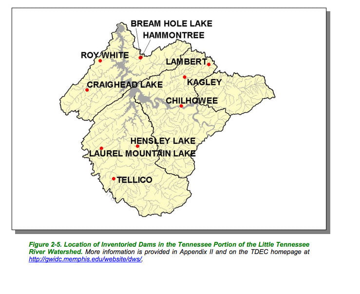
Little Tennessee River map of dams within the watershed
Courtesy of TN Department of Environment & Conservation
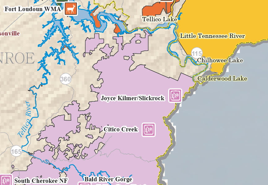
Little Tennessee River map – Calderwood Chilhowee Tellico Lakes

Little Tennessee River map of ecoregions within the watershed
Courtesy of TN Department of Environment & Conservation

Little Tennessee River map hydrology of the watershed
Courtesy of TN Department of Environment & Conservation

Little Tennessee River map of public lands within the watershed
Courtesy of TN Department of Environment & Conservation

Little Tennessee River map of towns and highways in the watershed
Courtesy of TN Department of Environment & Conservation

Little Tennessee River map of TWRA Wildlife Management Areas within the watershed
Courtesy of TN Department of Environment & Conservation