Lake Barkley Maps Boat Ramps
Shop Lake Barkley--Tennessee--Kentucky
 Lake Barkley Largemouth Bass sticker
$8.98$7.98 We Love Lake Barkley decal sticker
$5.98$4.98 Lake Barkley Crappie decal sticker
$8.98$7.98
Lake Barkley Maps
On Google’s Lake Barkley Map use controls to scroll, zoom, topography/terrain, charts, satellite, geography etc
TWRA and Corps Of Engineers Lake Barkley Maps charts below
*Lake Barkley Maps and charts are available commercially from:
Atlantic Mapping, Inc. PO Box 7391 Marietta, GA. 30065 770-426-5768 http://www.atlanticmapping.com/
*Localwaters provides information on commercial charts availability as a public service. This is not an endorsement nor do we receive compensation from Atlantic Mapping.

- Map above is courtesy of Region 2 TWRA
Click on links below for close up map of access areas and boat ramps
- Fairgrounds (1)
- Lock B Northside (2)
- Lock B Southside (3)
- Lock C boat ramp (4)
- McGregor Park boat ramp (5)
- Montgomery County Conservation Club (6)
- Smiths Branch Access (7)
- Trice’s Landing boat ramp (8)
- Yellow Creek Access (9)

- Map above courtesy of Region 1 TWRA
Click on links below for close up map of access areas and boat ramps
- Bellwood Landing (1)
- Bellwood Landing – River Ramp (2)
- Blue Creek (3)
- Bull Pasture boat ramp (4)
- Commissary (5)
- Dyers Creek boat ramp (6)
- Fron Bridge Ramp (7)
- Gatlin Point (8)
- Guices Creek (9)
- Hickman Creek (10)
- Lick Creek (11)
- Neville Bay (12)
- North Cross Creek (13)
- Riverbend boat ramp (14)
- Tobacco Port boat ramp (15)
- Wells Creek boat ramp (16)

Map courtesy of the Nashville District of the Corps of Engineers. High res ((3300 ? 2550) link here: LB COE
Restricted area below Barkey Dam NOT IMPLEMENTED due to well organized public pressure:
link to “Freedom to Fish Act” here
Map Corps of Engineers Safety Zone, Lake Barkley Dam. New as of 12/14/12
Water restriction tailwater safety zone below and above Lake Barkley Dam
Link to US Army Corps Of Engineers Nashville District Cumberland River Charts
Sample Corps map chart below, this has been down-sized, large PDF’s are provided directly from the Corps of Engineers.
Printed versions available, link leads to electronic versions as well.

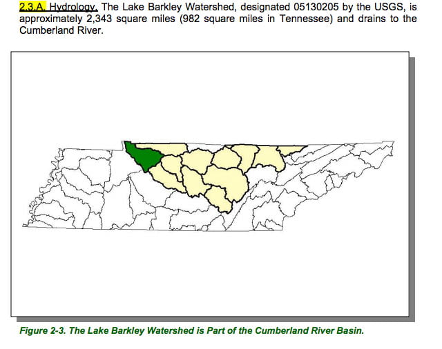
Map Courtesy of TN Department of Environment & Conservation
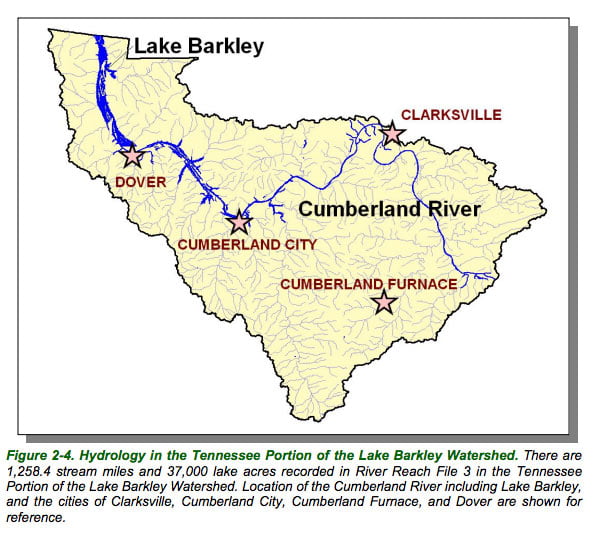
Map Courtesy of TN Department of Environment & Conservation
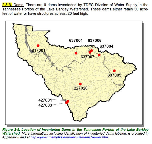
Map Courtesy of TN Department of Environment & Conservation
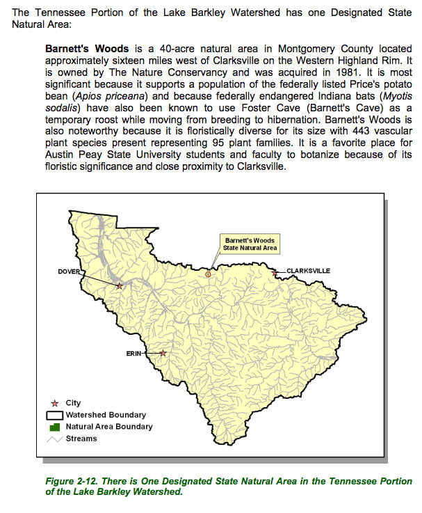
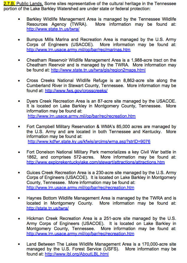
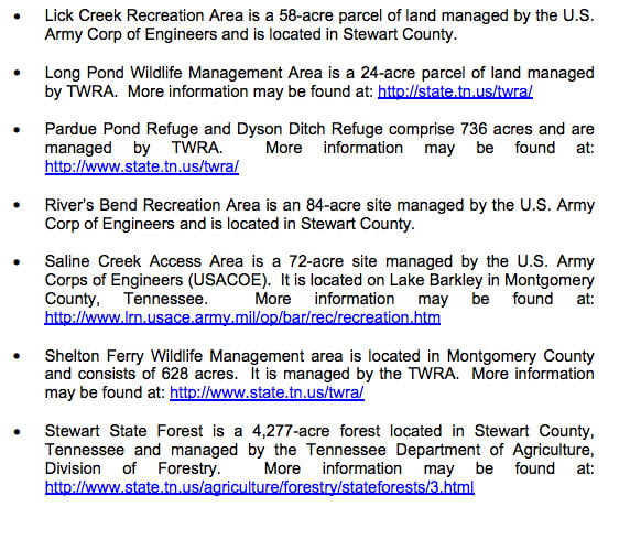
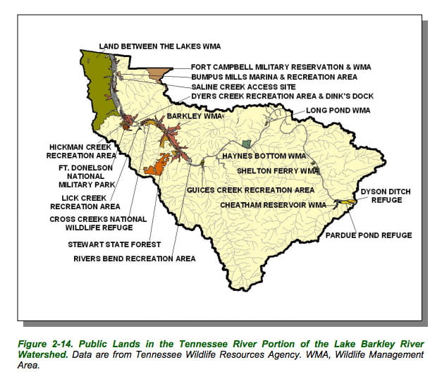
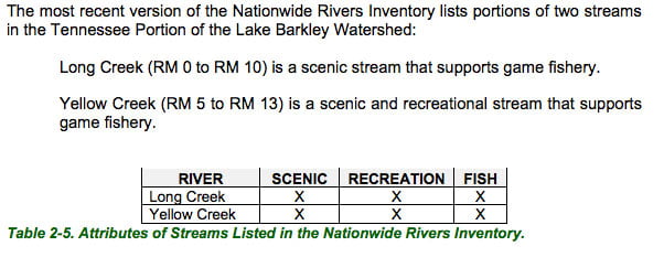
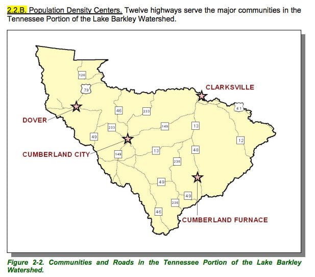
Maps and Facts Courtesy of TN Department of Environment & Conservation