Holston River Description
Shop Holston River--Tennessee
 Holston River Fly Fishing Sticker Tennessee Decal
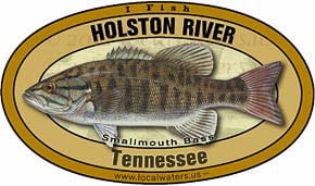 Holston River Smallmouth Bass sticker Tennessee decal
The Holston River of southwestern Virginia and east Tennessee
Native Americans called the Holston River “Hogoheegee.” Early explorers called it “Indian River” and French traders called it the “Cherokee River.” Today, the Holston River is named in honor of Stephen Holston (also spelled Holstein). Holston, an early
explorer and surveyor with The Expedition of 1748, was the first settler to explore the whole of the Holston River system, including South Fork of the Holston River.
The three major forks of the Holston (North, Middle and South Forks) begin in southwestern Virginia and have their confluence near Kingsport, Tennessee. The North Fork flows 138 miles (222 km) southwest from Sharon Springs in Bland County, Virginia. The Middle Fork flows 56.5 miles (90.9 km) from near the western border of Wythe County, Virginia, joining the South Fork inWashington County southeast of Abingdon. The South Fork rises near Sugar Grove in Smyth County and flows 112 miles (180 km) southwest to join the North Fork at Kingsport.From there the main stem of the Holston River flows 136 miles (219 km) roughly southwestward, just north of Bays Mountain, until it reaches its confluence with the French Broad Riverjust east of downtown Knoxville, Tennessee.This confluence is considered to be the start of the Tennessee River.
The Holston River valley has been greatly developed for electrical power generation, both with hydroelectric dams andcoal-fired steam plants. In the upper reaches, some of these plants are controlled by private interests; in the downstream portion, they are owned by the United States Government’s Tennessee Valley Authority. Among the dams and associated reservoirs on the South Fork Holston River are Boone Dam and Boone Reservoir, named for the explorer Daniel Boone;Fort Patrick Henry Dam and Fort Patrick Henry Reservoir, named for the Revolutionary War hero; and South Holston Damand South Holston Reservoir. Cherokee Dam on the Holston River forms Cherokee Reservoir, named for the historic Native Americans who occupied the areas along the Holston River at the time of European-American settlement. The United States settlers and army fought with the Cherokee over land and eventually removed most of them to territory west of the Mississippi River, under the 1830 Indian Removal Act.
The river was named after Stephen Holstein, a European-American settler who built a cabin in 1746 on the upper reaches of the river. Holston Mountain was named after the Holston River.
The Holston River is now defined as ending at the French Broad River, where the confluence forms the Tennessee River at its mile post 652 in Knoxville. Before 1933, the terminus of the Holston River was defined as the location 51 miles (82 km) downstream of Knoxville at Lenoir City, where the Little Tennessee River enters the river. That point, the confluence of the Holston and Little Tennessee rivers, was considered to be the beginning of the Tennessee River, 601 miles (967 km) upstream from the Ohio River at Paducah, Kentucky.
According to Tennessee Valley Authority historians, when the TVA was created in 1933, Congress mandated that the TVA headquarters be located on the banks of the Tennessee River. Since the TVA headquarters were already designated to be located in downtown Knoxville, as part of area development on what was then the Holston River, to fulfill the Congressional mandate, the official start of the Tennessee River was moved upstream from Lenoir City to the confluence of the Holston and French Broad rivers.
All three forks in Virginia, South Holston Lake, and the Holston River in Tennessee below the South Holston Dam offer relatively easy-to-reach recreation opportunities. The North Fork in Virginia is known as an excellent smallmouth bass river (due to mercurycontamination, fish caught in the North Fork of the Holston below Saltville, Virginia should not be consumed). Both the South Fork in Virginia and the first 20 miles (32 km) of the Holston in Tennessee below South Holston Dam are quality brown trout and rainbow trout fisheries. The Holston River is wide and open enough to allow extensive fly fishing. South Holston Lake offers a variety of fishing opportunity as well, as it contains smallmouth bass, common carp, walleye, pike, sunfish, crappie and a few trout.
Description above courtesy of Wikipedia
Please consider showing your appreciation of The Holston River by picking up some litter during your next visit, many hands make light work.