Hiwassee River Maps
Shop Hiwassee River--Tennessee
 We Love Hiwassee River decal sticker
$5.98$4.98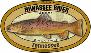 Hiwassee River Brown Trout sticker Tennessee Decal
$8.98$7.98 Hiwassee River Canoe sticker Tennessee Decal
$6.98$5.98 Hiwassee River Fly Fishing Sticker Tennessee Decal
$8.98$7.98 Hiwassee River Smallmouth Bass Sticker Tennessee Decal
$8.98$7.98 Hiwassee River Kayak Sticker Tennessee Decal
$6.98$5.98
Hiwassee River Maps
On Google’s Hiwassee River Map use controls to scroll, zoom, topography/terrain, charts, satellite, geography etc
TWRA and Corps Of Engineers Hiwassee River Maps charts below

- Map Courtesy of TWRA Region 3
- Click on links below for close-up map
- B&B Marina (1)
- Charleston Boat Ramp (2)
- Gee Creek (3)
- Gray’s Ferry (4)
- Highway 411 Bridge (5)
- Old Patty Bridge (6)
- Patty Bridge (7)
- Powerhouse (8)
- Tennessee State Park at Reliance (9)

Hiwassee River map of towns and highways in the watershed
Courtesy of TN Department of Environment & Conservation

Hiwassee River map of watershed hydrology
Courtesy of TN Department of Environment & Conservation

Hiwassee River map of dams in the watershed
Courtesy of TN Department of Environment & Conservation

Hiwassee River map of counties in the watershed
Courtesy of TN Department of Environment & Conservation