Great Falls Lake Maps Boat Ramps
Shop Great Falls Lake-Rock Island--Tennessee
 Great Falls Lake Bass sticker Rock Island Tennessee
Great Falls Lake – Rock Island Maps
On Google’s Great Falls Lake Maps use controls to scroll, zoom, topography/terrain, charts, satellite, geography etc
TWRA and Corps Of Engineers Great Falls Lake Maps charts below
Link to: TWRA Access Sites Cotten’s Marina
Link to: TWRA Access Sites Upper Caney Fork River and Great Falls Lake
Link to: TWRA Access Points Calfkiller River Tributary of Caney Fork River at Great Falls Lake
Maps below are of the Caney Fork River Watershed of which Great Falls Lake at Rock Island is a part.
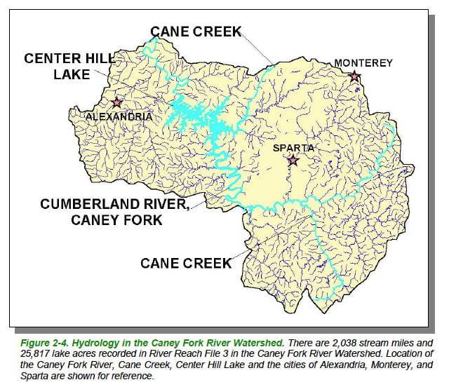
Caney Fork River Map Watershed-Courtesy of Department of Environment & Conservation
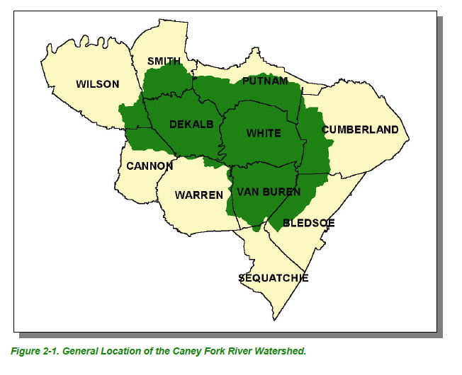
Caney Fork River Map Watershed Counties- Courtesy of Department of Environment & Conservation

Caney Fork River Map Ecoregions-Courtesy of Department of Environment & Conservation
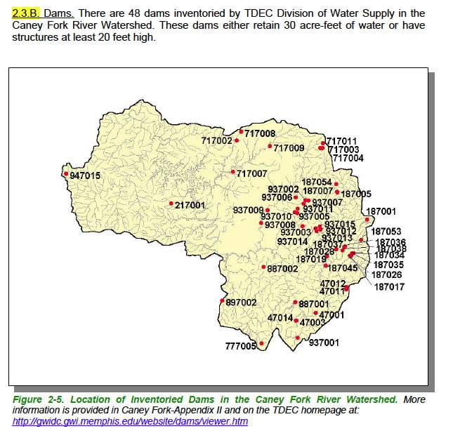
Courtesy of Department of Environment & Conservation
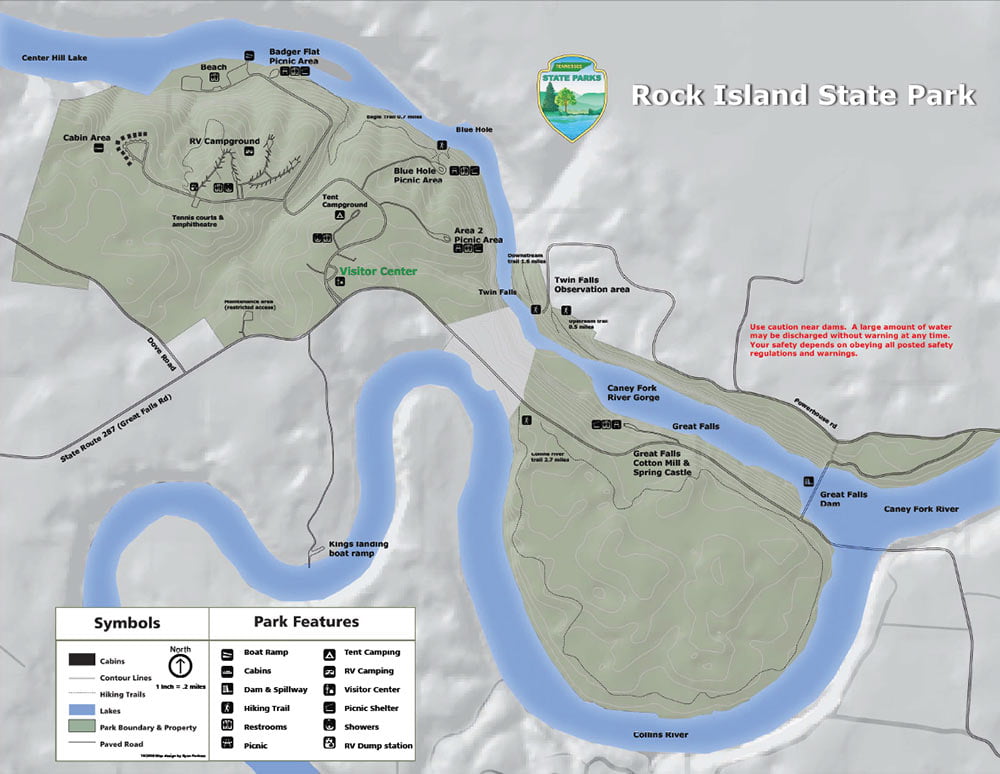
Great Falls Lake map of upper Center Hill Lake, Caney Fork River , Great Falls Lake, Collins River, Rock Island State Park and the Blue Hole
Link to PDF at higher resolution for printing: Rock Island State Park