Clinch River Maps TN
Shop Clinch River--Tennessee
 Clinch River Fly Fishing Sticker Tennessee Decal
$8.98$7.98 We Love The Clinch River decal sticker
$5.98$4.98 Clinch River Canoe sticker Tennessee Decal
$6.98$5.98 Clinch River Kayak sticker Tennessee Decal
$6.98$5.98 Clinch River Brown Trout fishing sticker Tennessee Decal
$8.98$7.98 Clinch River Grand Slam trout fishing sticker Tennessee decal
$8.98$7.98
Clinch River Map
On Google’s Clinch River Map use controls to scroll, zoom, topography/terrain, charts, satellite, geography etc
TWRA and Corps Of Engineers Clinch River Maps charts below

Clinch River map of watershed in Tennessee and Virginia
Link to PDF: Norris Lake Clinch River Tailwater Trout Access Points Ramps
Link to: TWRA Access Points Lower Clinch River

Courtesy TWRA Region 4
Clear Creek (1)
Highway 25E Bridge (2)
Highway 61 Bridge (3)
Kyles Ford (4)
Lewellyn Island (5)
Miller Island (6)
Peach Orchard (7)
Sneedville (8)
Songbird Canoe Access (9)
Weir Dam (10)
Clinch River watershed map of TWRA Wildlife Management Areas
Courtesy of TN Department of Environment & Conservation

Clinch River map state Scenic river portion
Courtesy of TN Department of Environment & Conservation

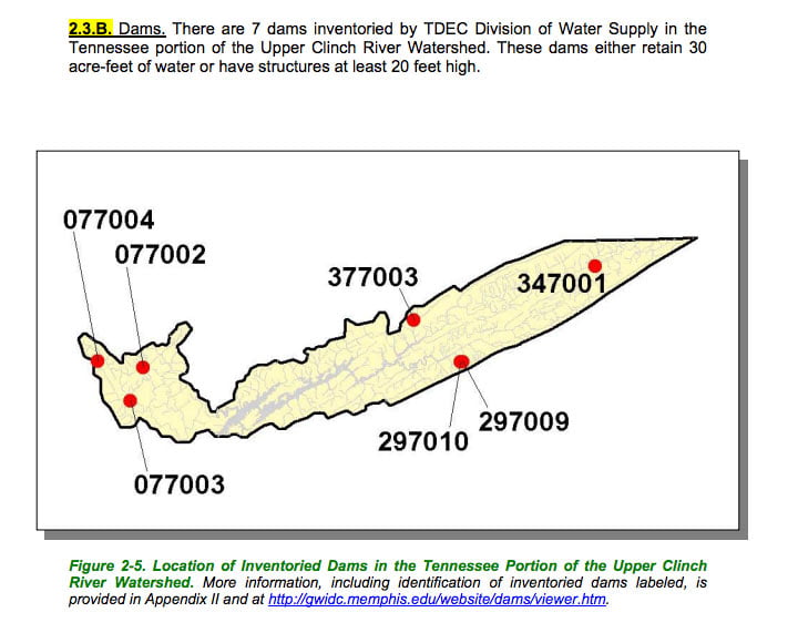
Clinch River map of public lands in watershed
Courtesy of TN Department of Environment & Conservation

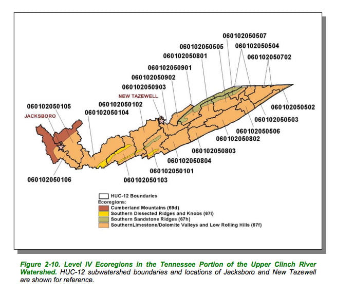
Clinch River map of ecoregions in watershed
Courtesy of TN Department of Environment & Conservation
Clinch River map counties in watershed
Courtesy of TN Department of Environment & Conservation
Clinch River map (lower) hydrology of southern portion of watershed
Courtesy of TN Department of Environment & Conservation
Courtesy of TN Department of Environment & Conservation
Courtesy of TN Department of Environment & Conservation
Courtesy of TN Department of Environment & Conservation

Courtesy of TN Department of Environment & Conservation
Courtesy of TN Department of Environment & Conservation
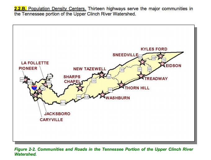
Clinch River map of towns, cities, highways in watershed
Courtesy of TN Department of Environment & Conservation