Chilhowee Lake Maps
Shop Chilhowee Lake--Tennessee
 Little Tennessee River Smallmouth Bass sticker
 Chilhowee Lake Smallmouth Bass sticker Tennessee Decal Fishing
 Great Smoky Mountains National Park Fly Fishing sticker decal
Chilhowee Lake Maps
On Google’s Chilhowee Lake Map use controls to scroll, zoom, topography/terrain, charts, satellite, geography etc
TWRA and Corps Of Engineers Chilhowee Lake Maps charts below

Courtesy of TWRA Region 4
Abram’s Creek (1)
Tabcat Creek (2)
Link to New TWRA Maps of Boat Ramps on Chilhowee Lake
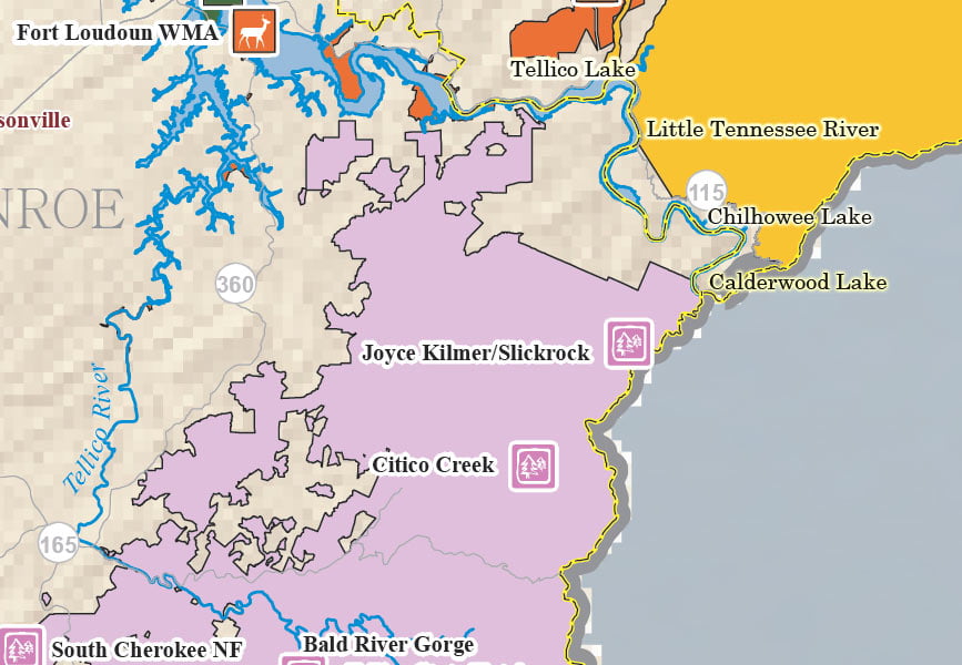
Chilhowee Lake Map Little Tennessee River Lake Calderwood Tellico Lake
Maps below are of the Little Tennessee River Watershed which Chilhowee Lake is part of
They missed Calderwood Lake Dam on this map
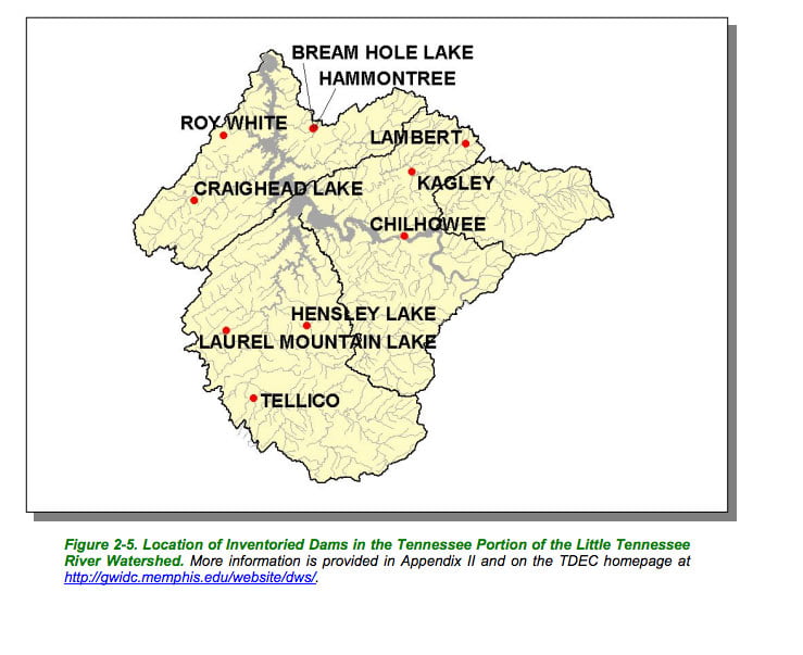
Little Tennessee River map of dams within the watershed
Courtesy of TN Department of Environment & Conservation

Little Tennessee River map of ecoregions within the watershed
Courtesy of TN Department of Environment & Conservation

Calderwood Lake is above (upstream) of Chilhowee Lake right where the map indicates Little Tennessee River
Chilhowee Lake map and Little Tennessee River map hydrology of the watershed
Courtesy of TN Department of Environment & Conservation

Chilhowee Lake map
Little Tennessee River map of public lands within the watershed
Courtesy of TN Department of Environment & Conservation

Little Tennessee River map of towns and highways in the watershed
Courtesy of TN Department of Environment & Conservation

Little Tennessee River map of TWRA Wildlife Management Areas within the watershed
Courtesy of TN Department of Environment & Conservation