Caney Fork River
Shop Caney Fork River--Tennessee
 Caney Fork River Canoe sticker Tennessee Decal
$6.98$5.98 Caney Fork River Grandslam trout sticker Tennessee fishing Decal
$8.98$7.98 We Love Caney Fork River decal sticker
$5.98$4.98 Caney Fork River Fly Fishing Sticker Tennessee Decal
$8.98$7.98 Caney Fork River Bass sticker Smallmouth Decal Tennessee
$8.98$7.98 Caney Fork River Brown Trout Fishing sticker Tennessee Decal
$8.98$7.98 Caney Fork River Trout Fishing Cloth Patch Limited Edition of 100
$10.98
Caney Fork River Trout Fishing Cloth Patch Limited Edition of 100
$10.98
 Caney Fork River Kayak sticker Tennessee Decal Paddle
$6.98$5.98
 The Caney Fork is 143 miles long and like all rivers, it changes its character dramatically from beginning to end. Historically called “The Caney Fork of the Cumberland” it was so named due to the unusually lush stands of river cane along the banks of the lower part of the river where it empties into the Cumberland. As the river descends from its source near Crossville, TN in Cumberland County on the the Cumberland Plateau, it flows at first with a modest descent.
 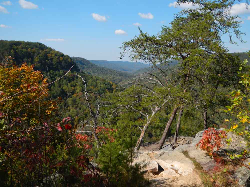 At the historical mining town of Clifty, the river plummets off the plateau and drops 700 feet in elevation within the steepest section of five miles. The river has a series of Class IV and V sections over it’s total 6-7 mile course through the gorge and is popular with paddlers in the spring. This gorge is the centerpiece of an isolated and beautiful wilderness known in whole as Scott’s Gulf, located in White County.
Smallmouth bass, musky, red eye bass and a variety of other fish inhabit the Caney Fork here mostly holding in the deep pools. It’s also known for its river otters, beaver, mink, bobcat, deer and some say the occasional bear. Falcons, hawks, eagles, ospreys and kingfishers, along with an assortment of other birds, make this remote gorge their home as well.
I’ve seen this section of the river in flood and it’s an awesome sight but the sound is even more impressive. The gorge echoes with the thunder of fast water in its narrow course while rolling giant boulders as if marbles down it’s channel.
I’ve also seen the area dry as a bone. In 2007 a family friend, fresh out of college and working for TWRA in a summer internship reported having made the hike from Virgin Falls to see some of the normally deep blue holes nearly dried up on the Caney Fork. Within a few days I arrived fishing pole in hand thinking I’d have easy pickings but all that was to be found were buzzards feasting on the carcasses of recently suffocated smallmouth bass in mere inches of water teeming with minnows. Several of the bass were in the 4-7 pound class range and it was a sad sight. I also found the remains of a large Musky just below the Fish Hole campground. The summer of 2007 was one of the driest summers in over 100 years in these parts.
Approaching the base of the Caney Fork gorge and just downstream from the steepest river section in Scott’s Gulf is a primitive river access area located just below the mouth of Bee Creek and above Big Spring. To get there from Virgin Falls State Pocket Wilderness continue on Scott’s Gulf Road. Care should be taken here, it’s best suited for high clearance four wheel drive vehicles in the last few hundred yards before the river and what appears to have once been the site of a rough ford usable by mules and wagons only in the dry season.
A series of good trails have been developed recently, which in this rough and wild land is no small feat, the main trail along the river being The Caney Fork River Trail. In addition to the extensive trails there are a series of primitive campgrounds. My favorite so far is Bee Branch Campground just up Bee Creek from the Caney Fork. I like this campground for its fine swimming hole and proximity to Rose Cave.
Along the river this particular area within Scott’s Gulf is known as the Bridgestone/Firestone Centennial Wilderness or Wildlife Management Area, depending on who you talk to. To the folks at Bridgestone, the property was known as Chestnut Mountain. In about 1970 over 15,000 acres were purchased by the Firestone corporation for use as a corporate retreat. Bridgestone bought Firestone in 1988 and initially sought to sell the land with provisions to protect the land from logging. After public pressure mounted Bridgestone decided not to sell the land and instead gave 4,000 acres of the land to the people of the state of Tennessee in 1998, then another 6,000 acres in 2000.
In 1999 I spent some time photographing the area on an assignment for Bridgestone. The company sought to publicize their generous gift before the second parcel was transferred and opened to the public. John Netherton, a nature photographer, friend and colleague of mine spent several months in the area and produced a book, with Senator Howard Baker, commissioned by Bridgestone; Scott’s Gulf: The Bridgestone/Firestone Centennial Wilderness. John Netherton’s work lives on and can be viewed at Netherton Nature. The book is available at amazon here: http://www.amazon.com/gp/product/0967782708/ref=olp_product_details?ie=UTF8&me=&seller=
Bridgestone employed private rangers that were attentive stewards of the land, knowledgeable of the ecology and the local traditions of the area’s use and history. During several tours and conversations with the rangers, they described scrambling to stay ahead of both game and tree poachers to protect and preserve this special place.
The Tennessee Trails Association and the Tennessee Parks and Greenway Foundation have been instrumental in expanding the boundaries of protected river and adjacent lands with the recent acquisition of the “Big Bottom Parcel” located at the very foot of the gorge. Big Bottom was transferred to TWRA and is now a Wildlife Management Area. It abuts both Virgin Falls Sate Natural Area and the Bridgestone tracts.
This area below the protective sandstone cap of the Cumberland Plateau is a limestone Karst topography with many caves (over 70 known in Scott’s Gulf alone).  The river here flows intermittently underground in the dry season through a series of sinks and sucks all the way to Big Bottom and the first bridge (Dodson) over the Caney Fork River downstream of Scott’s Gulf. It’s an unusual circumstance these days to find an unbridged section of river nearly 20 miles in length (Clifty Bridge to Dodson Bridge). It’s a testament to Scott’s Gulf’s rugged terrain that the automobile has been forced into such a considerable detour.
This Dodson Bridge (formerly known as Mitchell Bridge) that carries Big Bottom Road across the river to TWRA’s Big Bottom Wild Life Management Area (WMA) is a picturesque old iron bridge and it’s worth seeing before “progress” tears it down like what recently happened to the old Laycock bridge nearly one hundred miles downstream on the tailwater section of the Caney Fork River. Both of these old bridges and many more were rebuilt after being destroyed in the epic flood of 1929.
About a mile upstream from the Highway 111 bridge, Cane Creek enters the Caney Fork River from the south. This impressive tributary has carved its own rugged, steep gorge in its descent from the Cumberland Plateau, draining the waters of Fall Creek Falls State Park. Depending on the level of the pool on Great Falls Lake, the is river backed up and slack well upriver of the Highway 111 bridge.
 Great Falls Lake, the Collins River and the Caney Fork River were the site of the first Musky Fly Fishing World Championship, organized by Towee boats in March 2012. With careful management and catch and release practices, this area has the potential to become a World Class Musky Fishery. This is as far south as Musky naturally occur and the growth rate here is said to be much faster when compared to northern areas. The economic impact from fishing tourism would be substantial. Musky are almost a “cult fish” because they are the apex predator of freshwater fish.
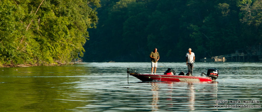
A good TWRA ramp and access point is located at Hwy 111. About a mile and a half downstream from there the Caney Fork is joined by the Calf Killer River draining the Cumberland Plateau from Sparta in the north-east. Great Falls Dam has backed slack water into the Calf Killer River. The next tributary of the Caney Fork is the Rocky River draining the land from the south. An interesting feature at the confluence with the Rocky River is “Rock Island” a sheer sided rock island from which the state park and town take their name. About a mile further down the Caney Fork is joined by the Collins River draining Savage Gulf and McMinnville from the southeast just above Great Falls Dam.

This is the only dam operated by the Tennessee Valley Authority (TVA) outside of the Tennessee River Watershed. Not long ago you could drive across the dam in a vehicle to get easier  access from the west to fish the Blue Hole but TVA has closed the dam to vehicular traffic for now.
Great Falls Dam was built by private interests in 1916, well before the birth of TVA. The dam is named for its site, the Great Falls of the Caney Fork of the Cumberland River.  Below the dam the river flows through a deep gorge for about a mile. Hikers and fisherfolk can access the river here by several trails the best of which is located at the parking lot next to the old Great Falls Cotton Mill at Rock Island State Park. Kayakers travel from all over the Southeastern US for the waterfalls and unusual hydraulics in this section of the Caney Fork River. I’ve heard of one particularly interesting hydraulic feature called “the Rodeo Hole” made reliable by it’s location just below the powerhouse. The river bed above the powerhouse is dewatered with minimal flow, though it is subject to higher water levels being released from the flood gates at the dam.
The powerhouse and turbines at Great Falls are not in the dam itself but are located about a half mile below the dam. Water flows through a tunnel cut into the nearby Collins River arm of Great Falls Lake. Below the powerhouse on river left is Twin Falls a group of artificial waterfalls that many visitors mistake as the namesake for the Great Falls section of the Caney Fork River.
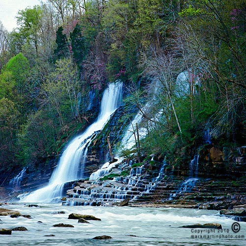 This set of waterfalls is actually a leak that formed when the water level in Great Falls Lake was raised by 35 feet in a 1923 addition in height to the dam. The higher water level found an existing cavern and leaked through the narrow ridge to cascade down the side of the gorge into the Caney Fork River. The Twin Falls were not created by design and are really nothing but a large and scenic leak!
The Caney Fork is again becalmed though just briefly not far below the powerhouse of Great Falls Lake and Twin Falls by a completely natural feature, The Blue Hole. The Blue Hole of the Caney Fork River is a long (several hundred yards) but deep depression of slack water that is the site of walleye spawning and as is protected by TWRA with special fishing regulations during the Spring Walleye Run. Draining the Blue Hole is a short run of ripples that sometimes are inundated by Center Hill Lake if the lake water level is high.
This is also the site of Rock Island State Park, rich in history and now a recreational mecca with cabins, campground, a beach and a boat ramp. The town of Rock Island and the area around Great Falls Lake was once quite a resort when the lake was the only lake of its size in Middle Tennessee.  Great Falls Lake was created before the impoundment of any of the other TVA lakes and well before the Corps of Engineers had dammed rivers and formed lakes along the Cumberland River. Imagine no Center Hill Lake, no Percy Priest Lake, no Old Hickory Lake or any of the many other lakes that we often take for granted in this “lake rich” area. It’s easy to see just what a recreational attraction the Caney Fork River and Great Falls Lake would have been to the people of the region from 1916 until the completion of the other dams in the region starting in about 1945.
Below the Blue Hole are the headwaters of Center Hill Lake, a 64 mile long reservoir of 18,200 acres. Renowned for its clean deep waters and outstanding smallmouth bass and walleye fishing, Center Hill was impounded in 1948 by the Army Corps of Engineers. Center Hill Lake’s shoreline is mostly undeveloped. One reason is that the area is hilly and the shorelines are steep. Another reason is that the Corps’ “red-line” or property line that is highest in elevation above the lake is much higher than most Corps lakes. This was in reaction to the complaints of farmers having their rich bottomlands forcibly purchased by eminent domain leaving them the scraps of unproductive hillsides. A compromise was reached by including the hillsides in the purchase and the result is apparent today in the undeveloped forested scenes around this special lake.
The next major tributary of the Caney Fork is the Falling Water River and it enters in a dramatic fashion at Burgess Falls State Park by way of a 135 foot waterfall. I have taken a boat nearly to the foot of the falls when Center Hill Lake’s level is high. In the summer, at normal pool, boaters can tie up to the ruins of an old mill and hike along a faint path of less than a hundred yards leading upstream to the bottom of Burgess Falls where they can frolic and swim.
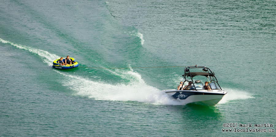
Just above the dam and straddling both sides of the lake is Edgar Evans State Park, with camping, ramps and Edgar Evans Marina. Improved facilities are located on the southeastern side of the lake, directly across from Cove Hollow Marina. This is the most popular part of the lake for boaters and skiers and traffic can be high on weekends.
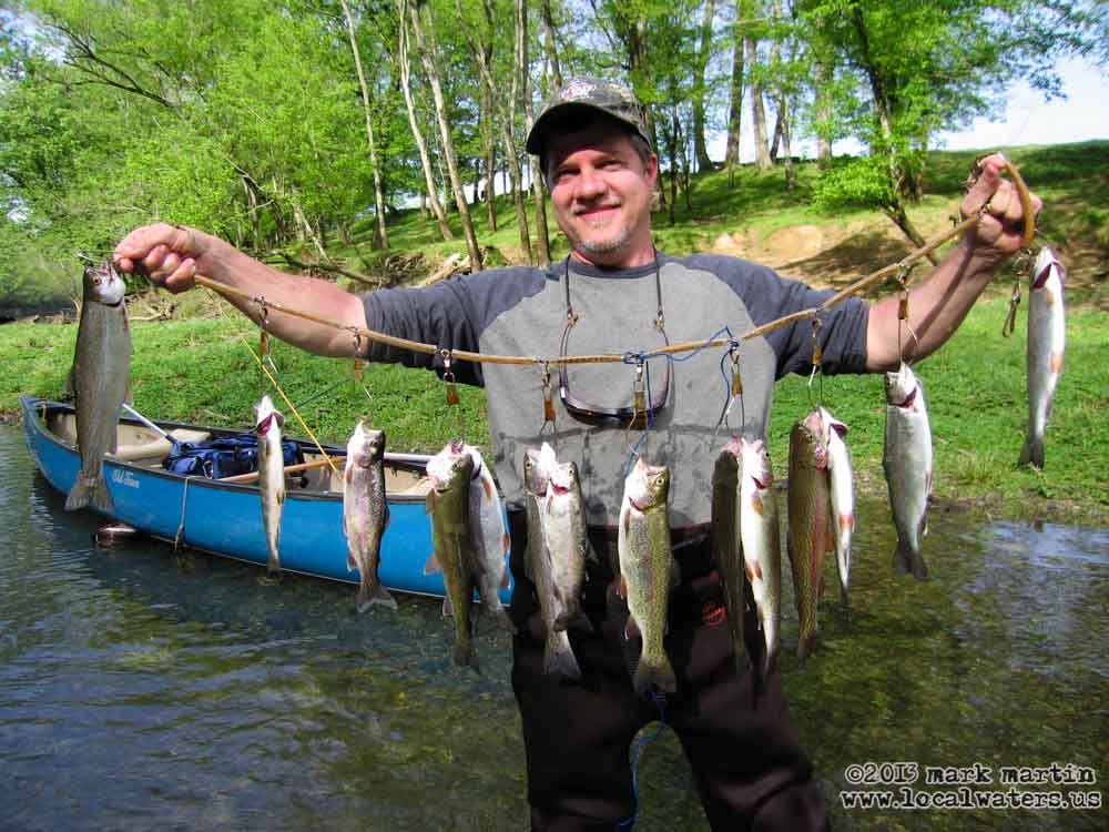
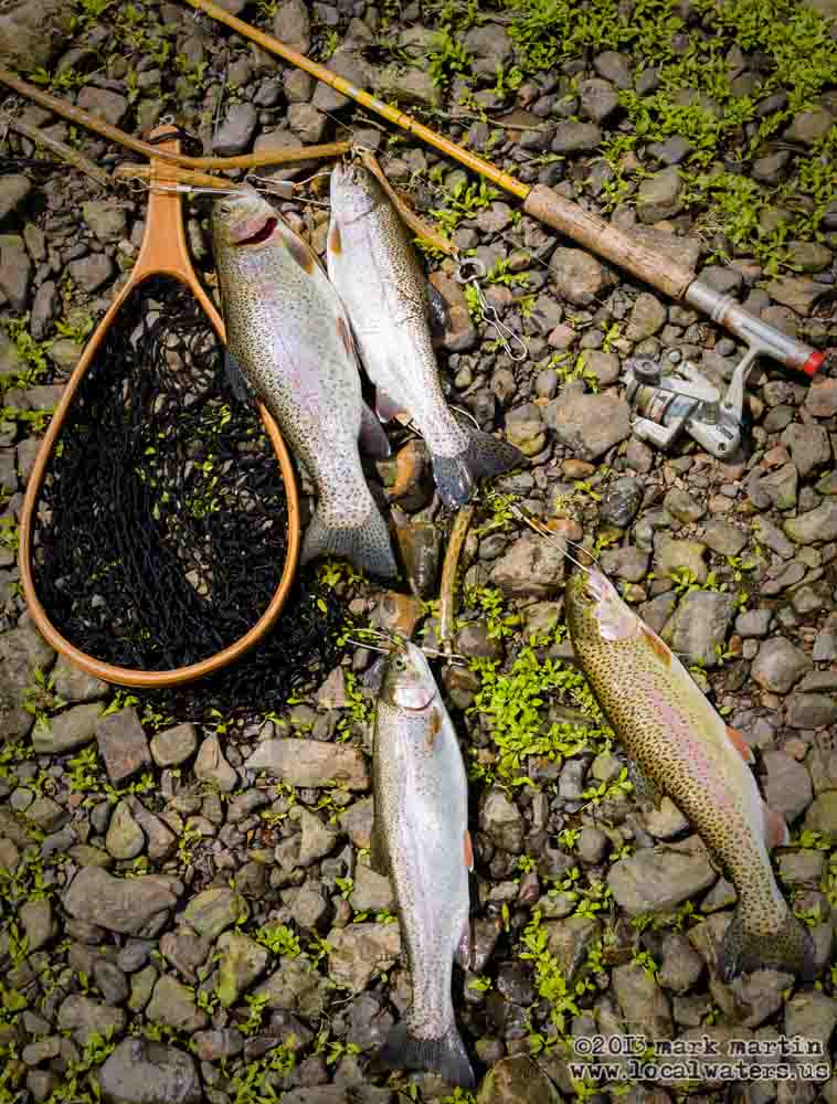
The damming of the Caney Fork by the Army Corps of Engineers via Center Hill Dam caused a warm water river to become a cold water river. This drove most of the native fish downstream into the Cumberland River and what was to later become, in 1954, Old Hickory Lake. To mitigate the impact on the native fishery from the much colder water flowing through the generators at the base of the dam, the TWRA along with the US Fish and Wildlife Service began stocking cold water fish: rainbow trout, brown trout and, more recently, brook trout.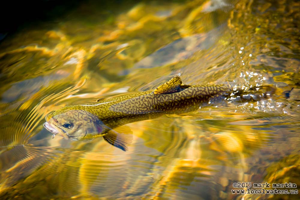
Among the latest controversies are budget inspired attempts by the United States Fish and Wildlife Service to persuade both The Corps of Engineers and TVA to pay for the USFWS hatchery operations for the fish reared for stocking of rivers in the tailwater sections that the mitigation program addresses. The hatchery funding has become a hot political issue that’s caused US Senators to become involved while fisherfolk and the many others who depend on their business remain stuck in the middle wondering just what the future holds for this fishery.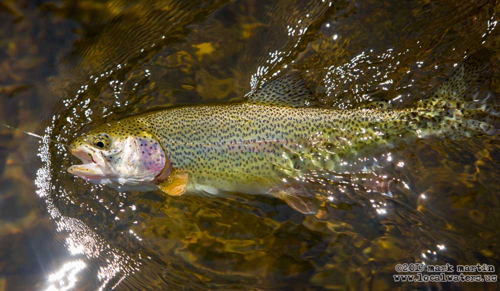
For the last couple of years the Corps has poured money into the repair of Center Hill Dam. It’s a major project made necessary by the porous Karst limestone features that the dam was built on. Center Hill Dam was identified as being at high risk of failure and over 100 million dollars have been spent so far with more than double that budgeted for the project.
Center Hill Dam is a hydroelectric facility with three turbines and the river can change fairly quickly depending on the amount of generation. Don’t expect a wall of water when they start generating. Call ahead for the generation schedule and don’t trust “zero generation” or zero CFS because they will often be operating the sluice gate and for some unknowable reason they don’t count that on reported CFS.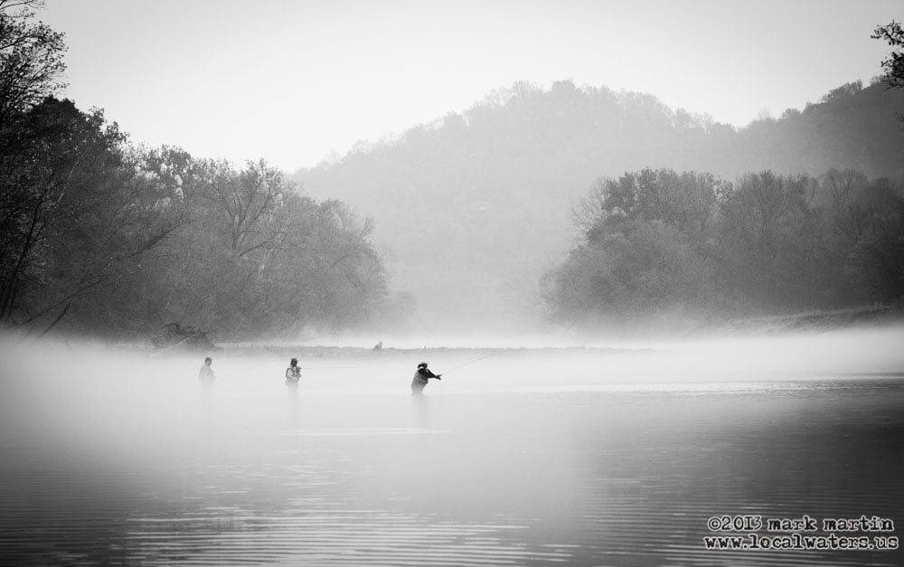 The practice of not counting the water released by the sluice gate has to change. Too many people have made plans based on this misinformation and driven far to be disappointed after arriving at a river that can’t be waded.
From the dam to the Caney Fork’s confluence with the Cumberland River is 26.5 miles.
It’s a very gentle river during periods of no generation from the dam without anything more than the occasional ripple between draining pools. Even during full generation with all three turbines operating it’s never rough water but moves fast with trees leaning over and sweeping the river being your greatest concern. It’s trout water all the way to the Cumberland River but depending on generation at Cordell Hull Dam, it becomes slack water at least a couple of miles before it empties into the Cumberland River and what is officially called Old Hickory Lake. TWRA has greatly increased access to the Caney Fork in recent years with ramp/access additions to the lower river.
At the dam, there is a ramp access for boats and canoes on both sides of the river. Buffalo Valley Recreation Area is located adjacent to the Center Hill Lake Resource Manager’s headquarters on the east bank and this is the side that Caney Fork Outdoors and the folks at Big Rock Market use to launch their rental canoes. The large area below the dam is commonly known as “the pond.” From the lower parking lot there is a well maintained path down river to some long gravel bars to fish from and wade. At the first bluff rock on your right you can wade across the river during low water and fish the opposite side from the gravel bar about 1/4 mile down. During times when there is no generation, you have about a half mile of wading on alternating sides of the river with easy access. On the west side is Long Branch Recreation area with an excellent campground and some sites overlooking the river. The east side 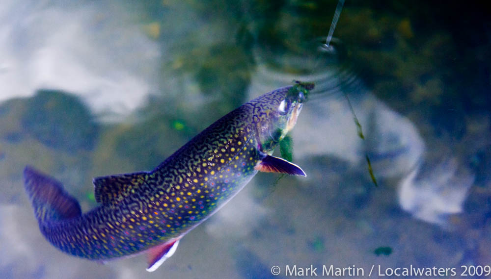 has an excellent ramp, screened-in fish cleaning stations with water, public restrooms, a playground and plenty of parking. You don’t have to be camping to use these facilities.
In addition a well maintained area for bank fishing from “the steps” is located along the tailrace directly below the dam. People fishing here catch some of the largest fish in the river by casting up into the current with spoons and jigs. I’ve sent many a cast into the current here to become snagged. After I’d lost too many dollars in lures here I realized my per lure price needed to be less than a dollar. When you catch a fish here though it’s usually worth the investment. It’s mostly the bigger fish that feed in this swift water. I fish it for walleye in the winter but even then I’ve seen some large trout and forty pound plus Rock Fish (Striped Bass) taken here.
A Description of the most popular river to float and fish in Middle Tennessee:
From the Dam to Happy Hollow Access Area, river mile 26.5 to 21.5
see map:http://www.lrn.usace.army.mil/op/cen/rec/maps/Caney_Fork.pdf
Canoeist and Kayakers should make a serious effort to give the fishermen standing and wading in the river the space they need to fish, go behind them when you can or just ask: which side they prefer you float past them, remember they have sharp hooks!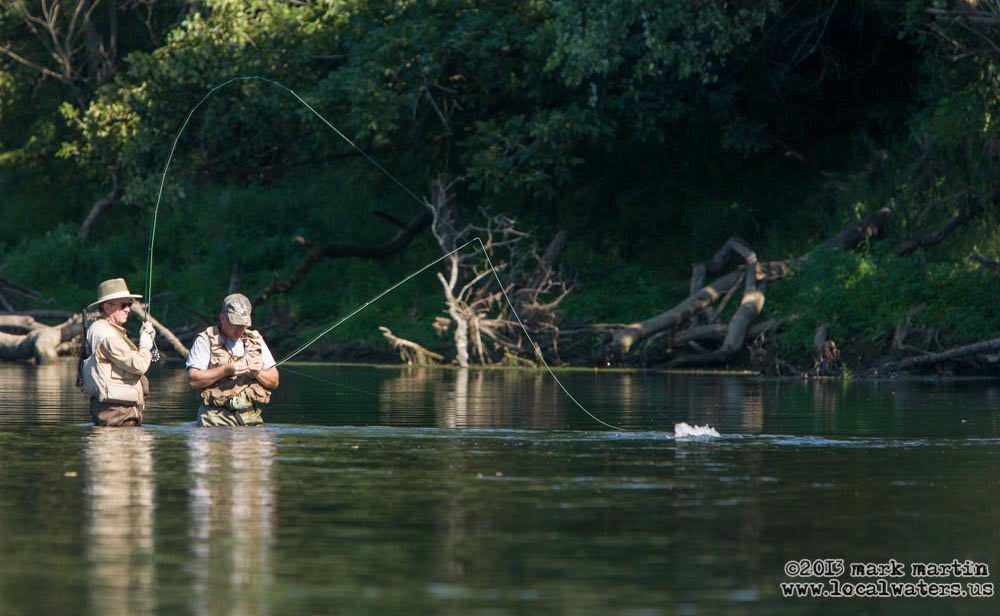
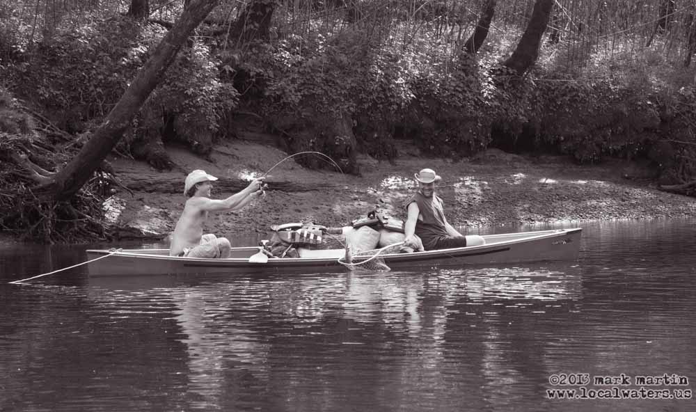
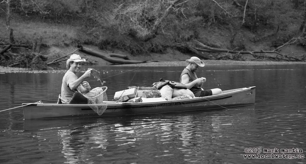
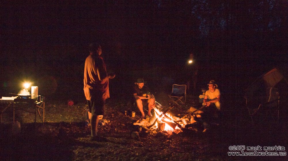
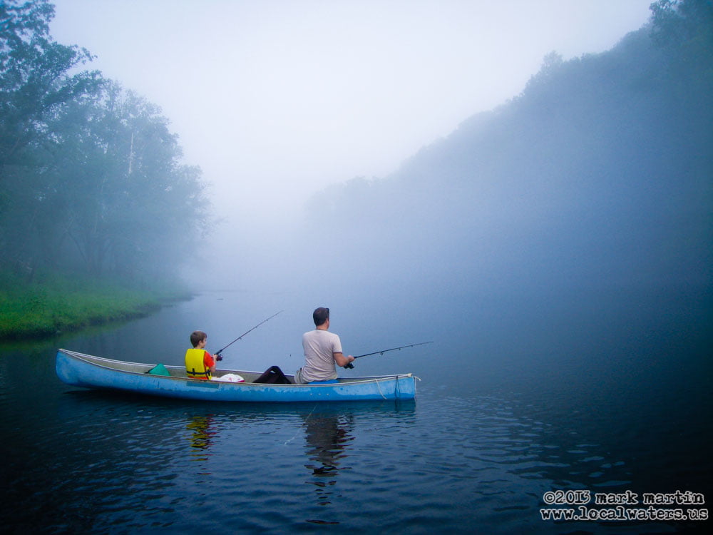
The highest traffic area on the Caney Fork River Tailwater is from the dam to Happy Hollow. It’s 5 miles from the dam and about a 2-3 hour float depending on generation and how you paddle. After the first bend on the river to the north and river left along Hwy 141 are several pull offs to park and fish or carry a canoe or kayak to the river, other than this short stretch the land along the river is privately owned but as long as you are respectful and behave the way you would want a visitor to in your own yard, you won’t have any problem pulling over for a short break. As a rule of thumb don’t venture beyond the high water mark or you are trespassing. Respect the locals, you are their guest. Enjoy the gravel bars, they are public property. Don’t camp on the gravel bars though, I tried it once and woke up wet and panicked in a tent with all my gear and canoe about to be swept down river. It was dark, hours before dawn with steadily rising water from an unannounced generation event. It left a lasting impression on me. There is no place to camp at all along the river’s tailwater other than the Longbranch campground at the dam unless you have permission from a land owner.
I-40 Rest Stop and Welcome Center
see map:http://www.state.tn.us/twra/gis/Boating/Boating_PDF/CaneyForkRiver/I40WelcomeCenter.pdf
After the first I-40 bridge on river left is a canoe, kayak and fishing access at the the I-40 Rest Stop and Welcome Center. No ramp is provided but plenty of parking is available and it’s a short
walk or portage/carry to the river. If you are on the river and need help this is a good place to get it and they do have vending machines and phones here.
Happy Hollow to Betty’s Island Access Area, river mile 21.5 to 18
see map:http://www.lrn.usace.army.mil/op/cen/rec/maps/Caney_Fork.pdf
Latitude: 36.13150 Longitude: -85.8071
1 Ramp: 1 Lane: Concrete
Do not leave a vehicle parked unattended on the gravel bar the river might take it.
 This is the second highest traffic area because a lot of people float from the dam all the way to Betty’s Island in one day. Plan on this taking 4-6 hours from the dam. After you pass Happy Hollow access on river right the river changes direction from north east to south west at Moss Bend. You will pass under I-40 three times, the last bridge is a half mile up river from Betty’s Island access area. A nice cave is river left just before the third bridge and it overlooks a long calm pool. The section of river from the dam to Betty’s Island seems to receive the highest stocking of trout. Several other caves are located along this section on private property above the high water mark.
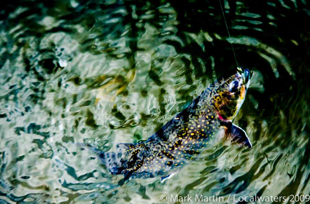
Betty’s Island Access Area to Stonewall Bridge Access area (AKA Gordonsville Access Area), river mile 18 to 12
see map:http://www.lrn.usace.army.mil/op/cen/rec/maps/Caney_Fork.pdf
Latitude: 36.1476 Longitude: -85.8397
1 Ramp: 1 Lane: Concrete
Do not leave a vehicle parked unattended on the gravel bar the river will take it.
Plan on this float taking 8-11 hours from the dam.
 This is back country where you encounter fewer people on the river. It’s a more peaceful float, especially on weekends when the crowds on the upper sections can compromise your float if you were expecting anything like solitude. Soon after you pass Betty’s Island Access you will float under Laycock bridge. It’s just been rebuilt (2011) and is safer now than the old iron bridge but I miss the rusted, wood planked beauty of that old bridge.
When floating the river look for the 4th I-40 bridge from the dam, the first for you if you launched at Betty’s Island Access. Here is the head of the real Betty’s Island and you need to make a quick decision, the right channel is narrower but deeper, if you are using a motor boat during zero generation take the right. You’ll have brown trout on river right and rainbows and brook on river left. Betty’s Island is privately owned above the high water mark and it’s enforced in my experience. At the end of Betty’s Island on river left is the confluence of Smith Fork Creek flowing into the Caney Fork River from due south.
The Tennessee Central Rail Road has a bridge over Smith Fork Creek here.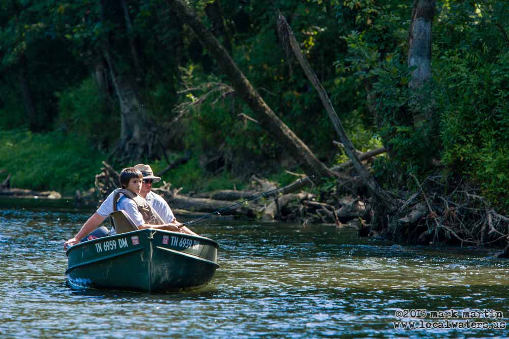
Smith Fork is the last major tributary of the Caney Fork River before it empties into the Cumberland River but still sixteen river miles above the Cumberland.
River left at the confluence is The Sebowisha and a very large gravel bar. On river right is a large river bottom and bend called Congo Bottoms. If you have trouble, Kirby road is across Congo Bottoms not far on river right. You won’t find a road on the Sebowisha side or up Smith Fork Creek until it reaches the bridge at Highway 141 where left leads back to the dam.
After you get around the Congo Bottom bend you will see the last I-40 bridge to cross the Caney Fork River from the east. It’s the first bridge over Caney Fork from the west. Take note if you cross the Caney Fork River from the west during heavy rains. You will notice that the river is very muddy at this bridge but not at the others. This is because Smith Fork Creek is up river and the other bridges cross Caney Fork where it can’t get muddy because of the dam. It’s a pleasant and straight float on to Stonewall Bridge on river right.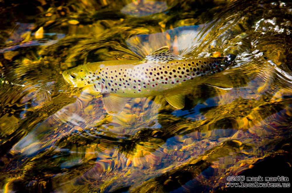
Stonewall Bridge Access Area (AKA Gordonsville Access Area) to South Carthage Access Area, river mile 12 to 7
see map:http://www.lrn.usace.army.mil/op/cen/rec/maps/Caney_Fork.pdf
Latitude: 36.185039 Longitude: -85.906548
1 Ramp: 1 Lane: Concrete
 Plan on this float taking 12-15 hours from the dam but don’t attempt this float from the dam in a canoe or kayak unless you’re in a race. You’ll find no place to camp and unless you are an experienced outdoor person, this river isn’t the place to be at night. In addition, you may get run over by another boat if you are in a boat without navigation lights (which is illegal and not a good idea). During higher water bass boats come up from the Cumberland and some bass boats go too fast. The access area is next to the Thayer S. Wilson Bridge on State Highway 264. This ramp is new, just opening in 2011 to fill a gap in public river access in this stretch. Here the river makes a gentle bend in the first mile and then flows straight northwest for three miles. At the end of this straight stretch you will see heavy industry on the bank river left. This is the Bonnell Aluminum plant. After this plant the river turns at Helm’s Bend aka “Hell’s Bend.” It so happens that my ancestors settled on this bend of the Caney Fork river in 1803 but the property is no longer in the family. It’s certainly easy to understand why someone living here would prefer it be called Helm’s Bend rather than Hell’s Bend yet it appears both ways on various maps. The ramp at South Carthage Access area is about half way into the bend on river left. Be careful, this ramp gets mud covered up to the high water line from all the sediment coming out of Smith Fork Creek upriver after heavy rains. When they built the ramp they finished the concrete too smoothly to allow for good traction after the buildup of mud. I’ve been glad to have a four wheel drive vehicle here on several occasions. One time the mud was so thick that I decided not to launch even with four wheel drive, so beware.
South Carthage Access Area to the Carthage Ramp on the Cumberland River/Old Hickory Lake, river mile 7 through river mile 0 and 1/4 mile on the Cumberland
 Plan on this float taking 4-6 hours. The last two miles is slack water and it’s like paddling on a lake.
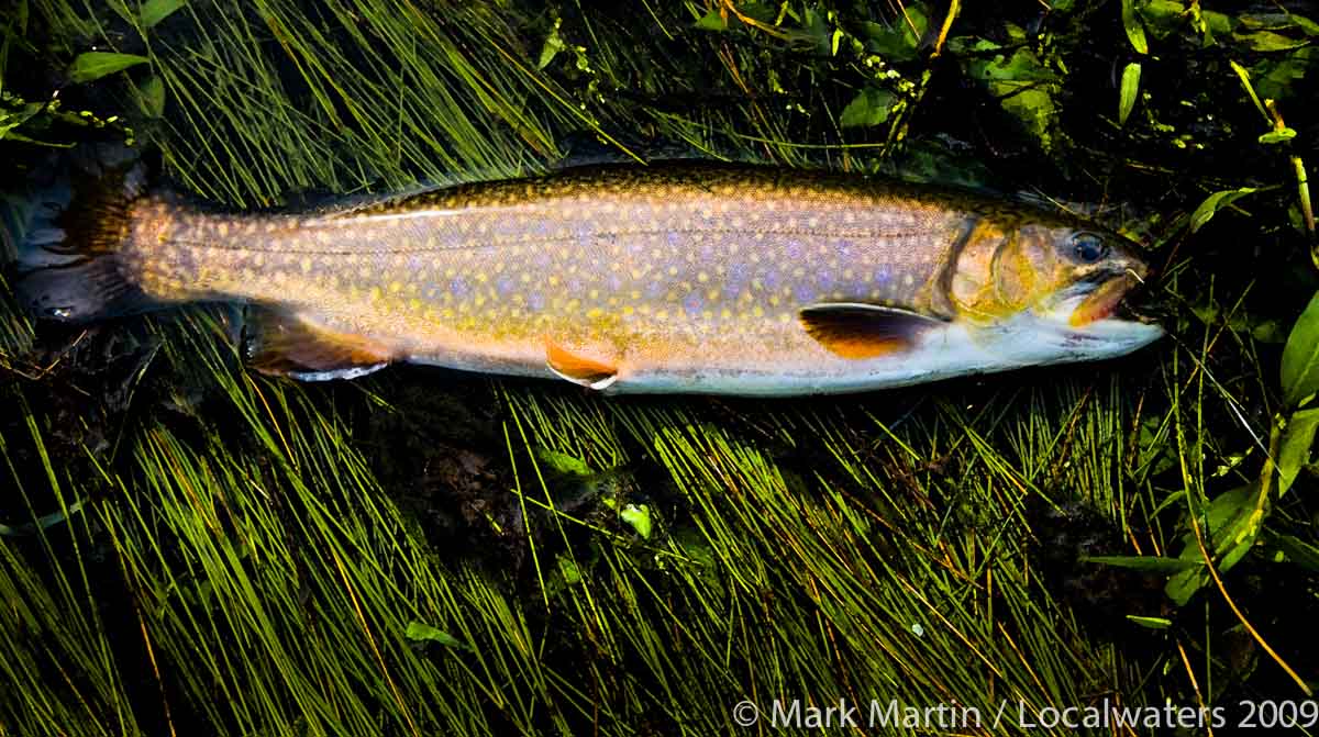
The banks get steep and muddy and it’s not nearly as scenic as the upper river. At about river mile 3, you will cross under the Hwy 70 N/53 bridge. A large submerged gravel bar here prevents bass boats from traveling further up the Caney Fork River during zero generation at Center Hill Dam and low generation at Cordell Hull Dam on the Cumberland. The river turns around Boulton Bend before making its final turn from north to due west and emptying into the Cumberland. At the mouth of the Caney Fork and the Cumberland river you can see the Hwy 25 bridge and just below the bridge is the Carthage boat ramp on river right. This concrete ramp is well designed and maintained and has a canoe landing next to it. I wouldn’t worry about barge traffic here, I have never seen a barge up the river this far. Cordell Hull lock and dam is just a couple miles up the Cumberland River from the mouth of the Caney Fork.
I love this river; I have family history strewn along its banks from the pioneer days when the Cherokee still lived upriver to the present day farm my family lives on within the Caney Fork River Watershed. My appreciation of this river is what inspired my idea for Localwaters because I wanted a sticker for myself and my friends that run this river with me.
If you have stories, historical information, photos or just-pictures of you with a fish, please contact me, I’d like to consider adding the information to the website.
By Mark Martin, May 2012
Consider showing your appreciation of the Caney Fork by picking up some litter during your next visit.
It’s been said that many hands make light work.